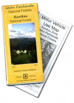
Idaho Panhandle National Forests Kaniksu National Forest Map
The Idaho Panhandle National Forests Kaniksu National Forest Map is the most comprehensive map the Forest Service produce for travel on forest roads and to trailheads and features in the northern portion of the Idaho Panhandle National Forests. This covers all of Bonner and Boundary counties, down to northern Kootenai County to include all of Lake Pend Oreille.
For roads and trails open to wheeled, motorized vehicles, we include the Motor Vehicle Use Map for the Kaniksu National Forest. Generally motorized winter travel restrictions are displayed on this visitor map as well as some non-motorized restrictions.
The Idaho Panhandle National Forests provide a wide variety of recreational opportunities for both summer and winter motorized and non-motorized activities. Stop by any Forest Service office and ask for information regarding recreation opportunities, specific activities and restrictions.
The Idaho Panhandle National Forests Kaniksu National Forest Map and Motor Vehicle Use Map are sold together and will be mailed together in your order.


