Regional Guide Books
Legendary Lake Pend Oreille: Idaho’s Wilderness of Water
By Jane Fritz and Friends
Nonfiction, 416 pages plus photo sections, 6″ x 9″
Softcover, 100+ photos, 16 pages of color plates, 16-page Ross Hall classic photos section, and fold-out color map by Terrapen Geographics.
ISBN 978-1-879628-33-5
Legendary Lake Pend Oreille is far more than a recreationist’s directory: Rich with sketches about biology and botany, loaded with fascinating historical lore, and abundantly illustrated, this is a bible for Lake Pend Oreille.
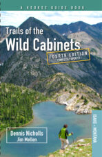
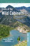
Trails of the Wild Cabinets – Fourth Edition
By Jim Mellen with Dennis Nicholls
Nonfiction, 199 pages, 6″ x 9″
Softcover, maps and photos, appendixes
ISBN 978-1-879628-86-1
Now updated in its fourth edition, discover the magnificent beauty of the Cabinet Mountains with the Trails of the Wild Cabinets guidebook! From easy day hikes to multi-day wilderness adventures, this guide provides descriptions for 100-plus trails with charts and maps to easily find hikes for all abilities. Also featured in this third edition is a new guide to trails suitable for mountain bikes.
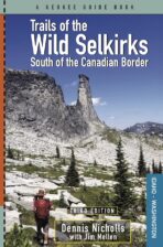
Trails of the Wild Selkirks: South of the Canadian Border – Third Edition
By Dennis Nicholls and Jim Mellen
Nonfiction, 344 pages, 6″ x 9″
Softcover, maps and photos, appendixes
ISBN 978-1-879628-58-8
Now updated in a brand-new 2022 third edition, Trails of the Wild Selkirks: South of the Canadian Border is the most comprehensive trail guide ever to the American portion of the Selkirk Mountains. The Selkirks host a stunning variety of landscapes, from lush temperate rain forests to dry ponderosa pine stands to naked granite on the high peaks. The Selkirk Mountains extend far north into Canada, but Washington and Idaho hold about a third of the range – plus an expansive, little-heralded trail system. Updated extensively in this new third edition, Trails of the Wild Selkirks provides detailed descriptions for more than 170 trails plus charts, maps, and photos to help hikers of all abilities easily find terrific trails and make their own discoveries in the beautiful, wild Selkirks.
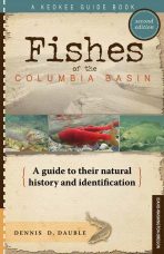
Fishes of the Columbia Basin – 2nd Edition
A guide to their natural history and identification
By Dennis Dauble
Nonfiction, 212 pages, 6″ x 9″
Softcover, 147 illustrations, glossary, list of fish species, index and 16 pages of color plates
ISBN 978-1-879628-50-2
For anyone who has a natural curiosity about the abundant variety of fish species in the Columbia Basin, fisheries biologist and author Dennis Dauble answers familiar questions and delves into a variety of factors related to 60-plus species in the second edition of his guidebook, Fishes of the Columbia Basin. The guide features 147 illustrations plus 16 pages of color plates, information on identifying each species plus information on their biology and behavior, and reference materials. If you’re on a quest for fishes and the places they live, Fishes of the Columbia Basin is an indispensable guide.
Climber’s Guide to North Idaho and the Cabinet Wilderness
By Thaddeus Laird
Nonfiction, 224 pages, 6″ x 9″
Softcover, 108 illustrations, 6 technical route topo maps, 62 photographic route overlays, 2 appendixes and 2 indexes, by route name and by rating
ISBN 978-1-879628-30-4
Climber and writer Thaddeus Laird rendered his years exploring the region’s rock crags and alpine peaks into the region’s most comprehensive climbing guide yet, Climber’s Guide to North Idaho and the Cabinet Wilderness. Laird followed after gurus Chris Kopczynski, John Roskelley and Randall Green to dig deeper into this unruly landscape of empty ranges and unclimbed routes.
On the Trail of the Ice Age Floods: The Northern Reaches
Third printing!
A geological field guide to northern Idaho and the Channeled Scabland
By Bruce Bjornstad and Eugene Kiver
Nonfiction, 480 pages, 6″ x 9″
Softcover, 400 black-and-white illustrations, maps and photos, 50 color plates, index
ISBN 978-1-879628-39-7
Following up on his first volume, On the Trail of the Ice Age Floods: A geological field guide to the Mid-Columbia Basin, geologist Bruce Bjornstad joined forces with colleague Eugene Kiver to guide readers upstream – northward into the Channeled Scabland and northern Idaho in The Northern Reaches. Illustrated with 400 maps, schematics, photos and illustrations, including 32 pages of color plates, On the Trail of the Ice Age Floods: The Northern Reaches provides a clear, concise and easily useable guide to the remarkable geologic record of the great Ice Age floods.
On the Trail of the Ice Age Floods
A geological field guide to the Mid-Columbia Basin
By Bruce Bjornstad
Nonfiction, 308 pages, 6″ x 9″
Softcover, 262 black-and-white illustrations, maps and photos, 20 color plates, index, in its fourth printing
ISBN 978-1-879628-27-4
In this first volume of On the Trail of the Ice Age Floods, geologist Bruce Bjornstad explores those legendary floods, explains the features they created, and guides readers to trails and tours in the Mid-Columbia Basin to witness the floods’ awesome power for themselves. This readable, useable field guide is rich in detail and makes the Ice Age floods tale more fascinating and intriguing than ever.
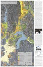
Glacial Geologic Map
Glacial Geologic Map of North Idaho and the Shaded Relief Map of Northern Idaho and Parts of Western Montana and Eastern Washington
This two-sided map includes a map titled Glacial Geologic Map of North Idaho on the front and Shaded Relief Map of Northern Idaho and parts of Western Montana and Eastern Washington on the second side. Glacial Geologic Map of North Idaho is a color map produced at the scale of approximately 1/175,000 and represents over 30 years of research and fieldwork by Dr. Roy Breckenridge, Former Idaho State Geologist and VP of Coeur du Deluge Chapter. The second author of this map was Dean Garwood, who following Roy’s passing organized Roy’s information and using his GIS skills put together multiple layers of information to produce the Final Map. The map is in commemoration of Roy and his dedication to the fields of Geology and Education and his commitment to our chapter and the Ice Age Floods Institute.
The back or second-side of this map is also a color map that was generated by Dean Garwood. This shaded colorized relief model was overlain with other important geographic information to make the map more useful. The shaded relief map was printed at a scale of approximately 1/198,000 and therefore covers a larger area on the Inland Northwest.
This large map is 33.75″ x 21.5″, and can be purchased either flat for wall display, or folded for use in the field.
Pocket Guide to Edible Plants of the Pacific Northwest
Including Their Medicinal Properties
By Dawn Trammell
Nonfiction, 152 pages
Softcover, Spiral Bound, 4.5″ x 3.5″, color photos
ISBN 979-9-218-38807-2
Pocket Guide to Edible Plants of the Pacific Northwest is written for hikers, backpackers, survivalists, medical missionaries, or anyone curious about the edible and medicinal uses of the local plant life. It was designed to fit into a pocket or backpack so one could always carry it with them. 136 Plants covering the entire Pacific Northwest with full-color photos of each! Included are the medicinal properties of each plant and how to prepare them for use in salves, tinctures, and ointments. For instance, if you are camping and get burned, did you know that making a paste/poultice out of wild violets or wild clover will heal the burn? Valuable information at your fingertips! (April, 2024 Edition)
*Not available for retailer discount
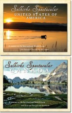
Selkirks Spectacular
A journey on the International Selkirk Loop
By Jerry Pavia and Tim Cady with Ross Klatte
Nonfiction, 180 pages, 11″ x 8.5″
Softcover, full color with more than 300 photographs
ISBN 978-1-879628-44-1
A photographic journey encircling the spectacular Selkirk Mountains of northern Idaho, eastern Washington and southeastern British Columbia, Selkirks Spectacular features amazing images by photographers Jerry Pavia and Tim Cady. More than 300 images along with chapters by Canadian Ross Klatte on the history, geology, communities, natural features, attractions, and the flora and fauna showcase this beautiful corner of the earth.
East of Yellowstone
Geology of Clarks Fork Valley and the nearby Beartooth and Absaroka Mountains
By Bob Carson
Foreword by Don Snow; photography by Duane Scroggins
Nonfiction, 184 pages, 11″ x 8.5″
Softcover, road logs, bibliographic references, full color with 138 illustrations including photos and maps
ISBN 978-1-879628-38-0
East of Yellowstone invites the curious into the dramatic geologic beauty of the Clarks Fork Valley just east of the world’s first national park, as guided by geologist and professor Bob Carson. Featuring beautiful images by photographer Duane Scroggins, this book is essential to exploring the geology along roads and trails outside Yellowstone National Park.
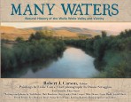
Many Waters
Natural History of the Walla Walla Valley and Vicinity
Edited by Robert Carson
Nonfiction; 224-page; 11″ x 8.5″
Softcover, full color
ISBN: 978-1-879628-48-9
Many Waters is a testament to the beauty of an extraordinary place. From the Blue Mountains to the Columbia River, southeastern Washington and northeastern Oregon, in particular the Walla Walla Valley, is a remarkable region, one that American Indians called Wallah Wallah, or Many Waters. And for good reason. It’s always been a bountiful place with its rich soils and streams teeming with fish.
Where the Great River Bends
A natural and human history of the Columbia at Wallula
Edited by Robert J. Carson
Nonfiction, 240 pages, 11″ x 8.5″
Softcover, full color, 264 illustrations including historic photographs and paintings, index, road log and bibliographic references
ISBN 978-1-879628-32-8
In Where the Great River Bends, Bob Carson and his colleagues tell a fascinating story through the prism of Wallula, the historic gateway to the Columbia Plateau – a striking land where the forces of geology worked on a spectacular scale, of a desert oasis where Native Americans, explorers, fur traders, promoters and entrepreneurs, and modern-day agriculturalists and wind farmers have all made their mark. Wallula Gap and its signature geologic feature, the Twin Sisters, are notable features left behind by colossal Ice Age floods.
